

The Seine is a vital transportation artery for Paris. It’s often called “the lifeblood of Paris,” and it’s also the most beautiful “boulevard” in the city. Much of Paris’s unique romantic charm comes from this river that divides the city in two.
The history of Paris has been tightly bound to the Seine since its earliest days as a Gallic village. The river has served many purposes over the years: it was part of the sewage system, but also a main source of drinking water, an important trade route, a place where washerwomen did their laundry, and even a spot where King Henri IV (r. 1589-1610) swam naked during the hot summer of 1609.
Anyone visiting Paris today can’t ignore the river that gives the city its distinctive character. The Seine winds lazily for 13 km through the city. It enters Paris from the southeast, near the Bois de Vincennes, and flows past three islands: Île de la Cité, Île Saint-Louis and the Île aux Cygnes. It rises in Burgundy and runs for 776 km before emptying into the sea at Le Havre.
Along the Seine’s banks you’ll find breathtaking views and most of the city’s major, must-see sights: the Eiffel Tower, the Louvre Museum, Musée d’Orsay, Notre-Dame Cathedral, Place de la Concorde, the Tuileries Garden, the Conciergerie and more. It’s no coincidence that the tour boats (the Bateaux Mouches) sailing the river carry powerful lights that turn these buildings into striking, unforgettable sights after dark. This is, without a doubt, one of the best ways to get your first taste of the city.
The riverbanks are a UNESCO World Heritage site. At the height of summer, large stretches of the Seine’s quays turn into urban beaches, complete with games, dancing, sand, palm trees, sun loungers, deck chairs, beach huts, hammocks, cafés and a Riviera-style atmosphere.
Paris’s 37 bridges, spread along the river and connecting the Right Bank to the Left Bank, play a crucial role in the city’s unique architectural heritage. Some of the bridges are world famous, while others remain little known. But every one of them is a great excuse for a walk along the river. You can enjoy the stunning Parisian views from any bridge, by day or by night.
No fewer than 12 bridges serve Île de la Cité and Île Saint-Louis. The main reason is that around these two islands the Seine splits into two branches, so separate connections are needed from the islands to the Right Bank and to the Left Bank. The oldest bridge is the Pont Neuf, opened in 1607, while the newest is the Pont Simone de Beauvoir, opened on July 13, 2006, which lets pedestrians and cyclists cross between the 12th arrondissement and the 13th arrondissement.
The Ten Most Beloved Bridges of Paris
Out of all these bridges, I picked my 10 favorites for this article. So let’s set off on a fascinating walk along the riverbanks. We’ll basically cross Paris from west to east, stopping along the way at the bridges on my list.
Pont Mirabeau
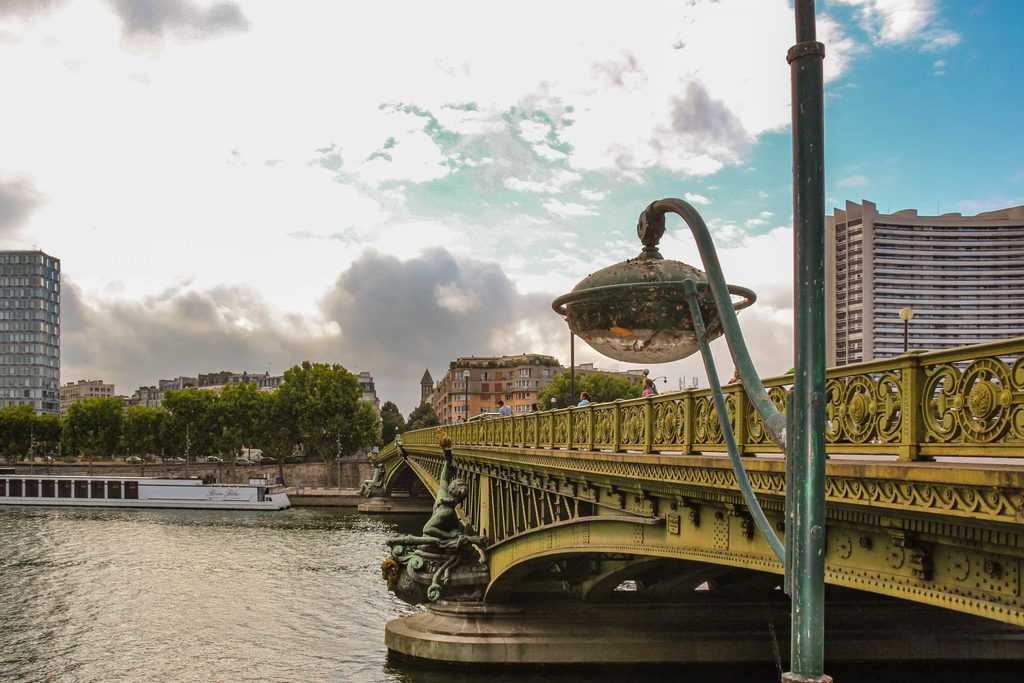
Our starting point is the Pont Mirabeau. It’s not in the heart of Paris, so it’s less well known to the general public. The bridge, 173 meters long, opened in 1897. It connects the 15th arrondissement and the 16th arrondissement. From the bridge you get a stunning view toward the Statue of Liberty and the Eiffel Tower. The poet Guillaume Apollinaire (1880-1918) wrote his famous poem “Le Pont Mirabeau” about it: “Under the Pont Mirabeau flows the Seine, and our loves too.”
Here is Serge Reggiani’s (1922-2004) unforgettable rendition of the song:
Pont de Grenelle
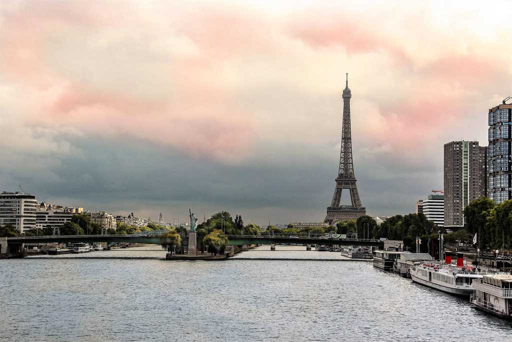
Pont de Grenelle connects the 15th arrondissement and the 16th arrondissement, next to the Maison de la Radio in France. It’s an arched bridge, 220 meters long, opened in its current form in 1966. Near the bridge, at the southwestern tip of the Île aux Cygnes, stands the largest Statue of Liberty replica in Paris. About a kilometer away is the Eiffel Tower.
Pont de Bir-Hakeim
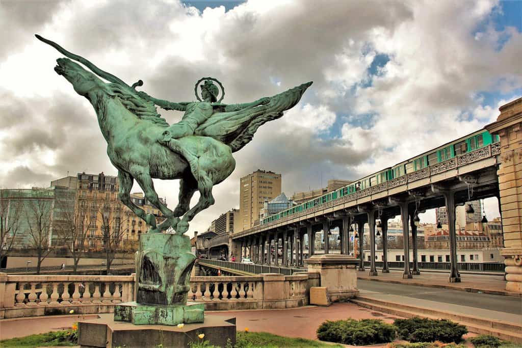
Pont de Bir-Hakeim connects the 15th arrondissement and the 16th arrondissement and touches the 7th arrondissement, very close to the Eiffel Tower. Metro line 6 runs over the bridge, partly on an elevated track, which gives you a sneak peek into the private apartments along the way. The sight is wonderful: the bridge on its two levels, the view from it, the general atmosphere, and “France Reborn,” a statue by Holger Wederkinch given to France by the Danish community in 1930.
Pont de l’Alma
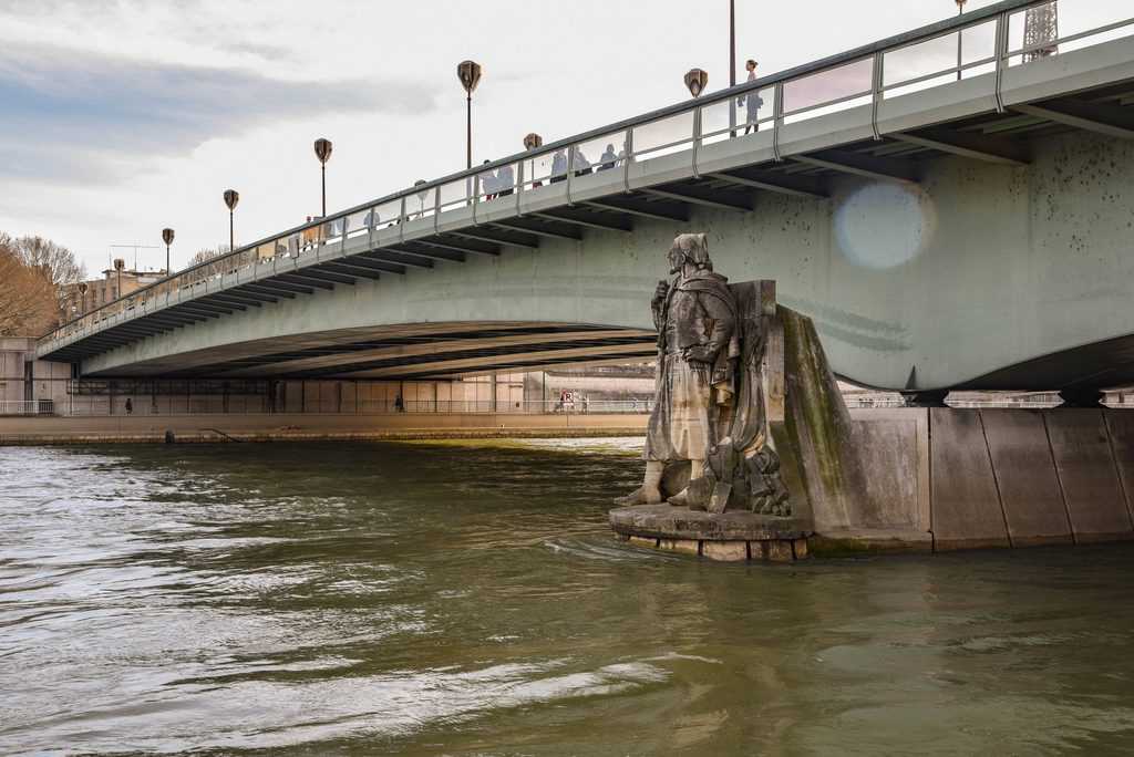
Continuing east, we’ll pass the Pont d’Iéna, which connects the Eiffel Tower to the Trocadéro, and the Passerelle Debilly, before arriving at our next featured bridge, the Pont de l’Alma, which opened in 1856 and was given a major renovation between 1971 and 1974. The bridge is 153 meters long and connects the 7th arrondissement and the 8th arrondissement.
Next to the bridge stands the Flame of Liberty monument, and in the tunnel beneath the bridge Princess Diana was killed in a car accident. Below the Pont de l’Alma stands the Zouave statue (pictured), which serves as a marker for the Seine’s water level. In 1910 the water rose so unusually high that it reached the chin of the startled, flooded statue. You can read more about that flood in the article Shaky but not Sinking.
Pont Alexandre III
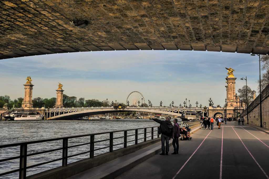
We pass the bridge by Les Invalides and find ourselves in a spectacular spot. Pont Alexandre III, connecting the 8th and 7th arrondissements, is without question the most beautiful bridge in Paris, with no real competition. Its cornerstone was laid in October 1896 by Tsar Nicholas II (1868-1918), and it’s named after his father, Tsar Alexander III (1845-1894). Construction was finished in 1900, just before the World’s Fair. The bridge sits between the Les Invalides complex and the Grand Palais and Petit Palais.
It’s covered in Art Nouveau decorations, ornate street lamps, statues, nymphs and gilded winged horses set at each corner of the bridge. This is one of the best spots in Paris to get some fresh air and take in the scenery: the gleaming copper ornaments and gilded cherubs on the bridge itself, and the wonderful views stretching out in every direction, including an especially striking one of nearby Les Invalides.
Pont de la Concorde
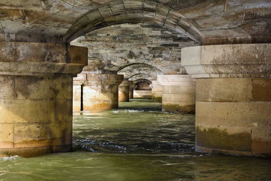
The Pont de la Concorde opened in 1791. It connects the 7th arrondissement to the prestigious Place de la Concorde in the 8th arrondissement. The bridge’s central location lets you take in stunning views in every direction. The photo you see here was taken from underneath the bridge. Everyone photographs it from above, so I decided to do something different and capture an unusual, original angle. Some of the bridge’s stones were brought over from the Bastille after it was torn down. The stated goal was “to let people trample on the ruins of the old fortress forever.”
Pont des Arts
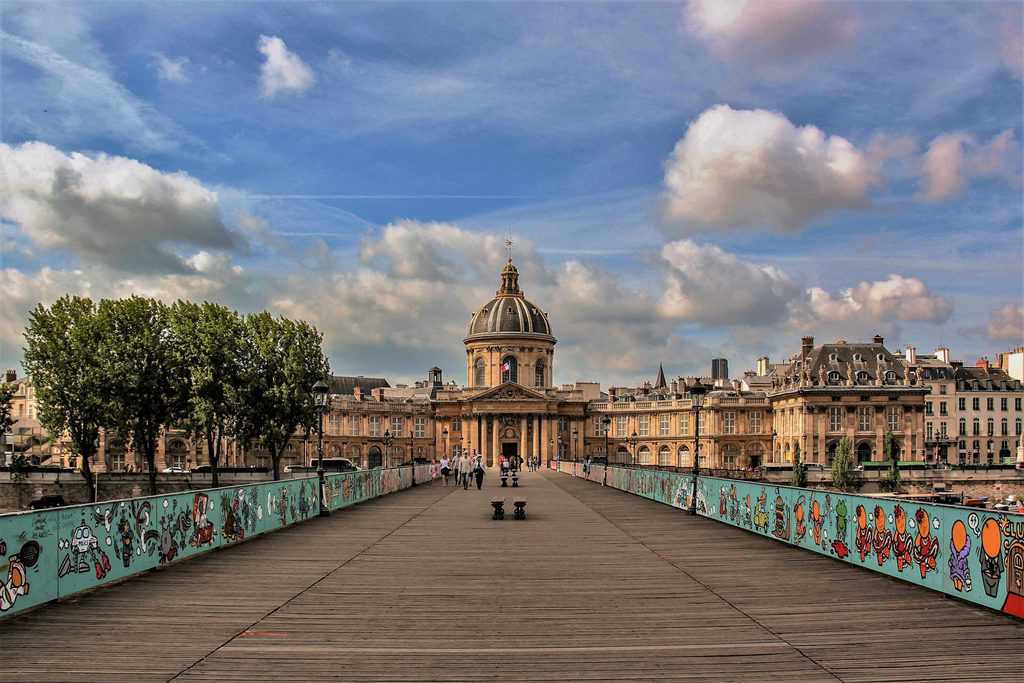
We keep heading east. With the Tuileries Garden and the Louvre Museum on our left, we’ll pass the Passerelle Solférino across from Musée d’Orsay, cross the Pont Royal and the Pont du Carrousel, and arrive at one of the most famous and remarkable bridges in Paris: the Pont des Arts.
The current Pont des Arts is a 1984 replica of Paris’s first cast-iron bridge. It’s made of steel and connects the Louvre Museum in the 1st arrondissement to the 6th arrondissement. The Pont des Arts opened in 1803 and was the first bridge built for pedestrians only. In its early days, you had to pay a toll to cross it.
On its opening day, 65,000 Parisians paid to walk across it. Until a few years ago, thousands of love locks hung from its railings, and it was known as the bridge of locks. The city of Paris removed the locks for safety reasons. At the southern end of the Pont des Arts stands a striking building with grand columns and a large dome. This is the Institut de France, built in 1688. The institute houses five academies. The Académie française, founded by Cardinal Richelieu (1585-1642), is the best known of the five and one of the world’s most important academies in the field of linguistics.
You can read more about both the bridge and the academy in the article The Story of the Pont des Arts and the Institut de France.
The Pont Neuf
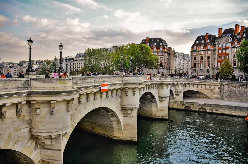
Its name means “the new bridge” (Pont Neuf), but it’s actually the oldest bridge in Paris. On May 31, 1578, King Henri III (r. 1574-1589) laid its cornerstone. At its center stands a statue of King Henri IV, who opened the bridge on horseback in 1607. The bridge’s architecture is an example of the Italian Renaissance. It connects the 1st arrondissement and the 6th arrondissement.
It’s one of the best known and most beautiful bridges in Paris. The bridge is 275 meters long and rests on 12 arches, each topped with carved grotesque figures. From the bridge you get wonderful views along the Seine, including the Louvre Museum, the Institut de France, the Pont des Arts and more.
We’re now at the western tip of Île de la Cité. Here, right at the tip of the Square du Vert-Galant, beneath the Pont Neuf, the Seine splits into two branches.
On the Left Bank side you’ll find the Pont Saint-Michel, the Petit Pont, the Pont au Double and the Pont de l’Archevêché. On the Right Bank side there’s the Pont au Change, the Pont Notre-Dame and the Pont d’Arcole. Île de la Cité and Île Saint-Louis are connected by the Pont Saint-Louis, a very romantic bridge at sunset.
Pont au Change
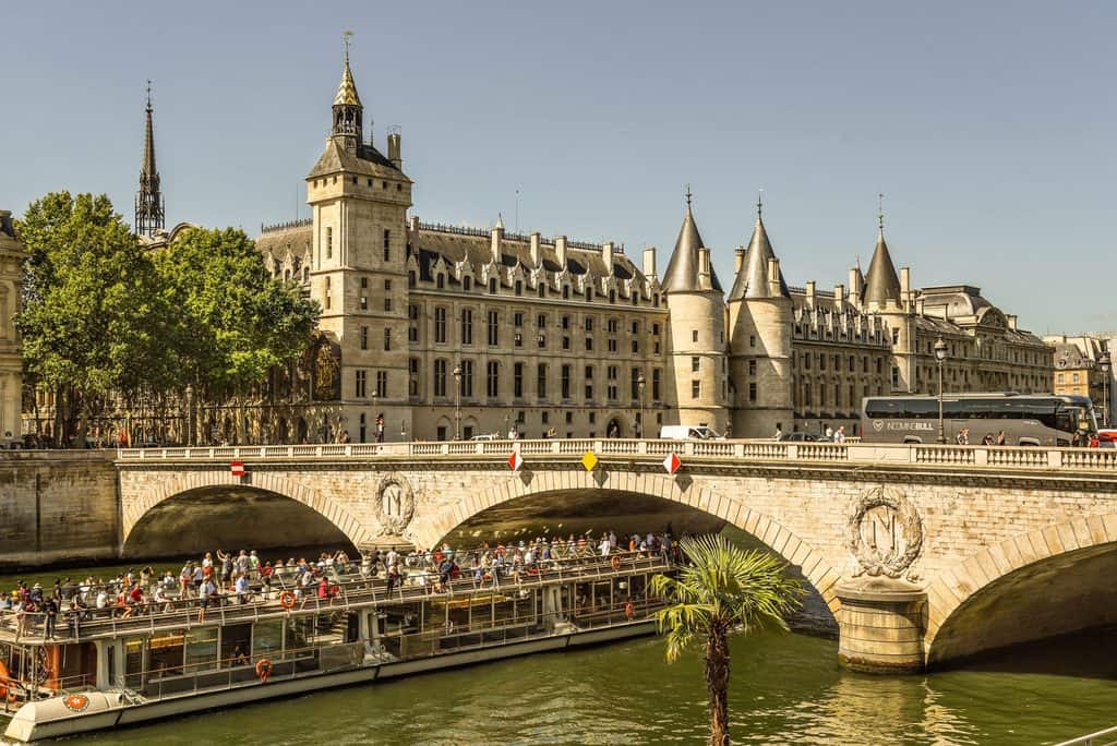
Among the many bridges connecting Île de la Cité, I chose the Pont au Change. It spans the Seine between the 1st arrondissement and the 4th arrondissement, next to the magnificent Conciergerie building seen here in the background. The bridge was built in the 9th century. Starting in the 12th century, money changers (bankers) set up shop on the bridge, which is where its name comes from (“bridge of exchange”). To be precise, in 1141 King Louis VII (r. 1137-1180) set up a currency exchange office there.
Shortly after, the king ordered all the money changers to set up shop on the bridge, which is how it got its name (first “bridge of the changers,” and ever since, “Pont au Change”). Over time, the money changers’ stalls and the goldsmiths’ and jewelers’ shops built on the bridge multiplied so much that you could no longer see the Seine below. In 1788 the houses and shops on the bridge were torn down, and the view was restored to residents and visitors.
Île Saint-Louis also has a few important bridges of its own. Where the island meets the Right Bank, you’ll see the Pont Louis-Philippe and the Pont Marie. The Pont de Sully stretches across the eastern tip of the island, next to Square Barye. Just before it is the Pont de la Tournelle, where we’ll end our tour.
Pont de la Tournelle
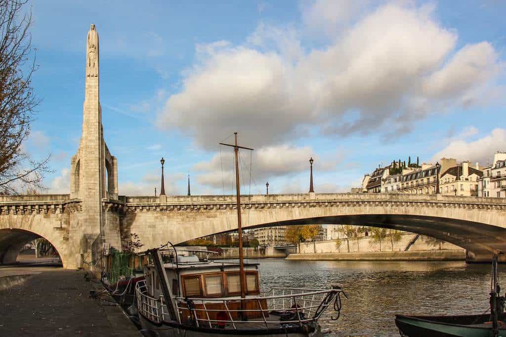
The original Pont de la Tournelle was built of wood in 1370. The current bridge was widened and renovated between 1923 and 1928. It connects the 5th arrondissement to Île Saint-Louis. From the bridge you get a wonderful view of Notre-Dame Cathedral. I really love the combination of the bridge, the river, the boats and the tall statue. A statue of Sainte Geneviève, the patron saint of Paris, stands on the Pont de la Tournelle, watching over the boat traffic on the river. The statue is the work of Paul Landowski (1875-1961), a French artist of Polish descent, who later became world famous for creating the giant “Christ the Redeemer” statue towering over Rio de Janeiro in Brazil.
