
In short
- Route: From Sainte-Marie-aux-Mines in the north to Cernay in the south, 88 km.
- Highest point: The Grand Ballon, 1,424 meters, the highest peak in Alsace.
- Along the way: Mountain passes, mountain lakes, a botanical garden for alpine plants, farm inns (fermes-auberges), and the World War I memorial site at Hartmannswillerkopf.
- Getting there: By car only. You can take the train to Colmar or Strasbourg and rent a car there.
- When to go: Parts of the road are usually closed from mid-November to early April, and the alpine garden is open from June 1 to September 30.
Anyone who knows France and has traveled around it has probably visited, or at least heard of, the Alsace Wine Route (Route des vins d’Alsace), one of the most famous wine routes in the world (there are many, see “The Wine Routes of France“). But only a few have heard of the “Route des Crêtes,” which runs not far from it. In fact, even though the two routes are close to each other and run parallel, they have nothing in common. The Route des Crêtes today is a string of departmental roads (the “yellow” roads on Michelin road maps), including D48, D148 and D430.
It’s worth noting that France has a few other roads with this name: the “Route des Crêtes” of the Basque Country, in the Pyrenees (around the town of Oloron-Sainte-Marie), a shorter route around the Gorges du Verdon, and also “crest roads” in Provence and the Cévennes.
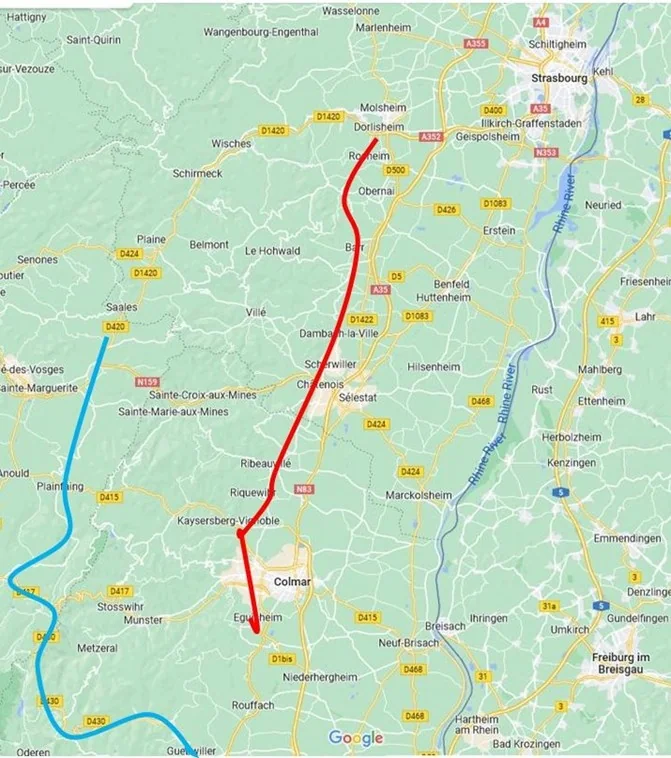
No traveler, apart from locals who live in the area, comes here just for the Route des Crêtes. I highly recommend combining it with a trip along the Alsace Wine Route, and more broadly with a trip through Alsace as a whole. Strasbourg, Colmar, Thann, Munster, Kaysersberg-Vignoble, Riquewihr… these are just a few of the dreamy destinations in the area. You can easily plan a “zigzag” trip, moving east and west between the two routes, combining wonderful wines with charming towns and villages and breathtaking scenery.
How the Route des Crêtes Was Born
After the Franco-Prussian War (1870-1871), Alsace was annexed to Germany, while the Vosges region to its west, in Lorraine, remained French. When World War I broke out in 1914, the Vosges Mountains became a front line between Germany and France, and both armies dug in on opposite sides of the border: the German army on the eastern slopes, and the French army facing it, on the western slopes.
The French quickly realized they needed to move supplies, soldiers and ammunition to the dug-in positions. The French army’s engineering corps connected existing winding roads, paved new ones, and created a narrow, winding supply road along the mountain peaks, running north to south, at a time when no one was yet thinking about a tourist or scenic route. The road links several small rural roads and secondary routes that wind along the western slopes of the Vosges, which kept them hidden from the German forces’ lookouts to the east.
The road begins in the north, around the town of Sainte-Marie-aux-Mines, and ends in the south, near the town of Cernay, after 88 kilometers. It was only after the war, and especially after World War II, that residents and travelers discovered the potential of this winding road and its scenery.
The Route des Crêtes Today
Today the Route des Crêtes is a tourist road linking mountains and villages. Its highest point lies at the foot of the Grand Ballon, the highest peak in Alsace (1,424 meters). “Ballon” is a term from the old Alsatian language whose origin and exact meaning aren’t entirely clear, but it likely refers to a high peak.
The Vosges mountain range (Vosges, like the beautiful square in Paris…) isn’t especially high, is green year-round, and 60% of it is covered in forest. Above the 1,000-meter line (some say 1,200), trees no longer grow, and the hills are covered in green grass and a variety of wildflowers: a paradise for the cattle herds of Alsace, which come up here every summer for a few months of fresh, varied grazing. On the route described here, you won’t find beautiful or fascinating towns, must-see sites or important museums, just a wonderful sequence of breathtaking landscapes, green peaks and crystal-clear lakes.
Eating at the Mountain Farms
Scattered along the roads of the region are farms where the farmers and their families run restaurants and inns (fermes-auberges). It’s worth stopping at at least one farm to taste the local food, which is largely unfamiliar to many visitors. The dishes are hearty, with lots of potatoes and butter (when the cook tells you she added “a little butter, for flavor,” there’s usually a whole block of butter sitting in the pot). Everything is seasoned with sausages and bacon (lard), both homemade, and often soaked in some kind of local alcohol. For variety, you might try a round pastry filled with ground meat and a mix of spices (tourte)…
Important: on weekends, it’s a good idea to book ahead (you can find details online or at the local tourist offices).
Points Along the Route
The points below are listed from north to south, in the recommended direction of travel. Don’t hesitate to stop “just because” along the shoulder of the road (carefully!) to take photos or simply admire the view, even at spots not mentioned here.
Because of the snow, parts of the road, mainly in its northern section, are closed to car traffic, usually from mid-November until early April.
Sainte-Marie-aux-Mines
“Holy Mary of the Mines” is a small town whose uniqueness lies in its location: in the Middle Ages there were actually two villages here, one on each side of the border, one in Lorraine and the other in Alsace. Both villages grew up around silver and lead mines, and eventually merged into a single town. Its golden age came in the 16th century, when about 3,000 miners worked here, and once the mines were depleted, a textile industry flourished here in the 19th century. Today it’s a sleepy town of about 4,000 residents, with a few churches and one synagogue, which was destroyed in World War II. The local tourist office organizes guided tours of a silver mine (details on the tourist office’s website).
Col du Bonhomme
The “Good Man’s” mountain pass, at an elevation of 949 meters. Local tradition says that the nearby village was founded by a priest who arrived in the area and, through his kindness, influenced all the residents… This is one of two major mountain passes in the area, even if it’s not the most impressive one, and it connects the valleys of Alsace in the east to those of neighboring Lorraine in the west. The paved road here, the Via Petra, is known from Roman records and has always served as a border line between the territories of local rulers.
During World War I the pass saw fierce fighting and heavy shelling. Like many mountain passes, you’ll find a small restaurant or café here, ski trails in winter and luge trails in summer. Fourteen hiking trails set out from here in every direction, into the valleys and mountains around, and some of them are long and very difficult.
Gazon du Faing and the Lakes
In modern French, gazon means lawn, while in medieval French it referred to a mountain pasture (pré d’altitude). This is a granite ridge south of the Col du Bonhomme, on the way to the Col de la Schlucht. At an elevation of about 1,200 meters, right at the tree line, the ridge is unforested, but it’s covered in dense natural grass and a profusion of flowers, and it’s considered an excellent pasture area where herds of goats and cows graze in summer. Some of the milk used to make Munster cheese in the valley, one of the most “fragrant” cheeses in the world, comes from here. But the taste… and who knows, maybe you’ll get lucky and spot some of the mountain’s animals, like the chamois and the mouflon.
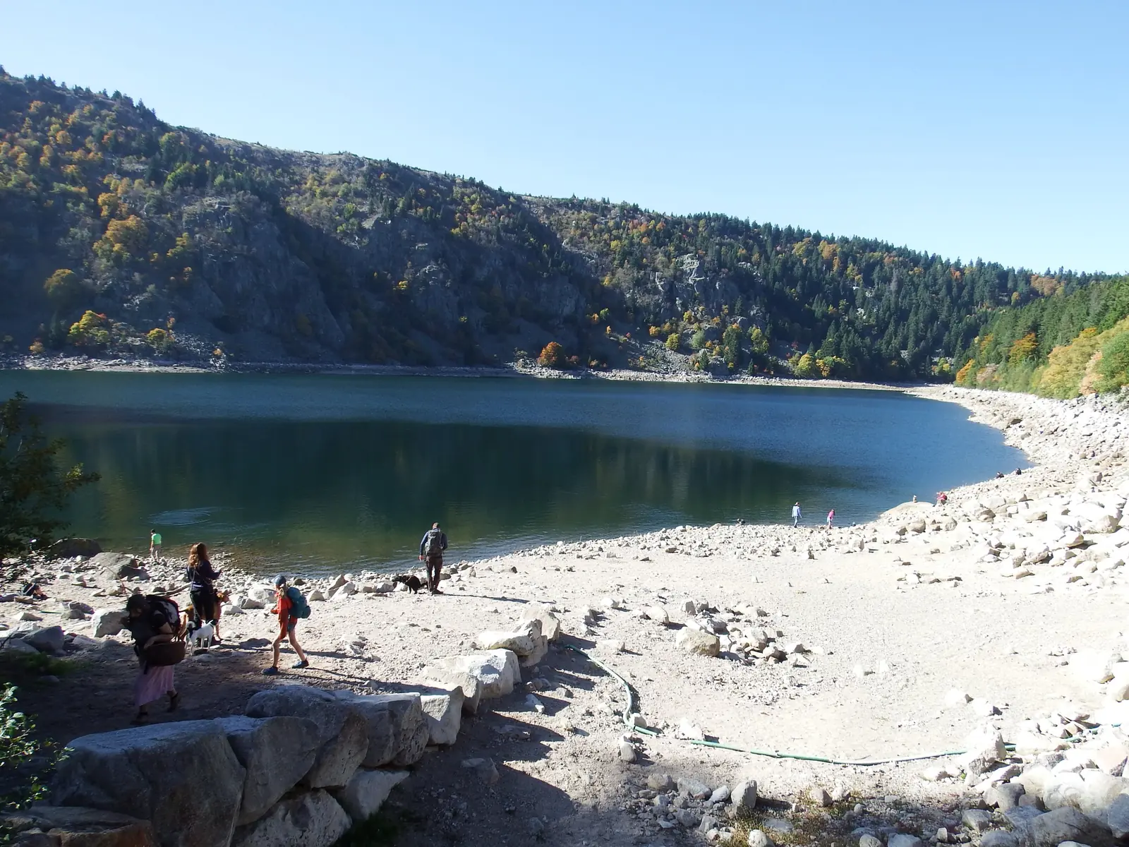
The area is dotted with mountain lakes, including Lac Noir (the Black Lake) and Lac Blanc (the White Lake), and a bit farther away, Lac Vert (the Green Lake). All of these make the view from the ridge especially beautiful. The two small lakes are surrounded by hills and forests, and a walking path circles each of them. Sitting on the shore with a sandwich or a cup of tea (coffee works too) is a moment of peace and connection with nature.
Col de la Schlucht
At an elevation of 1,139 meters, this is the second pass connecting the valleys of Lorraine to those on the Alsatian side (Schlucht means ravine or gorge in German). It was only in the mid-19th century that two local industrialists turned the goat path that once ran through here into a proper paved road, initially as private property that included a relay station and a large hotel. After Napoleon III visited the area in 1860, the road passed into public hands.
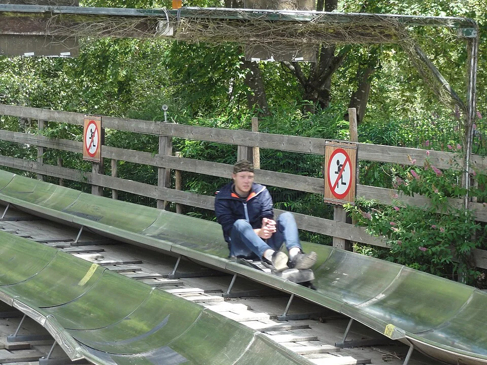
Ski trails opened here as early as 1905, but it wasn’t until 1949 that France’s first ski school was founded here. Today it’s a busy and highly sought-after relay station and ski resort, surrounded by beautiful scenery and many hiking trails, both short and long. In summer, a luge track (bob luge) operates here.
The Alpine Garden of Haut-Chitelet
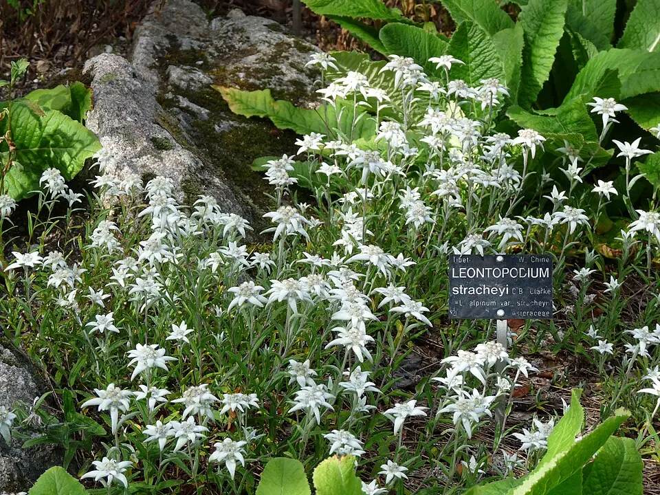
Farther along the road south of the Col de la Schlucht (route D430) is a botanical garden for high-altitude plants, the Jardin d’altitude du Haut-Chitelet, also known as the Jardin Alpin. The garden sits at an elevation of 1,210 to 1,228 meters, is managed by the botanical gardens of Nancy and the University of Lorraine, and cultivates more than 2,500 species of high-altitude plants from various places around the world. The first garden was founded in 1903 at the Monthabey farm, not far from the Col de la Schlucht, and was destroyed during World War I. It wasn’t until after World War II (1954) that the current site, suited to a mountain garden, was found.
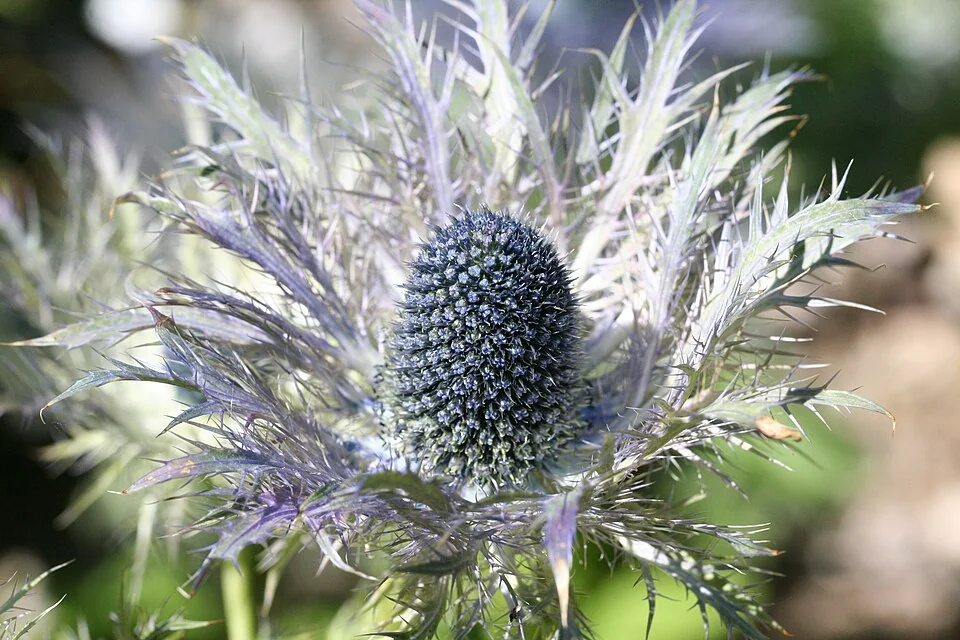
The site gets 2,500 millimeters of rain a year and snow from October to the end of April, with an average temperature of 3.5 degrees Celsius. The garden’s plots are arranged by the plants’ regions of origin, including Japan, New Zealand, Siberia, the Caucasus and many others. The garden is open to the public from June 1 to September 30.
Le Hohneck
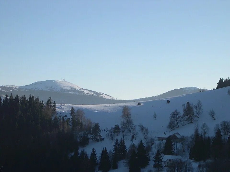
Another peak on the ridge, at an elevation of 1,363 meters. Here too there’s a small tourist center from which short and long hiking trails set out in every direction, and here too beautiful mountain views unfold on every side.
Lac de la Lande
By now you get the idea: the road is stunning, breathtaking views open up at every bend, and your camera’s shutter button gets quite a workout… One of the most beautiful views along the route opens up from the road a bit south of the botanical garden, near the Breitzhousen roadside restaurant: down the slope of the ridge sits a gorgeous mountain lake, even though it’s actually artificial, created behind a dam built in 1983 to generate electricity.
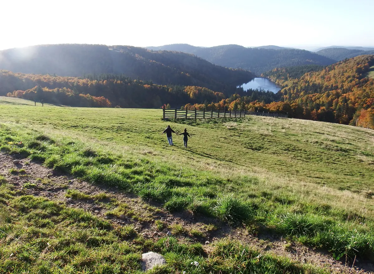
The hills around it, the grassy slopes and the forests on the mountainsides… no, this isn’t a scene from a fairy tale (and it’s not AI-generated either). It’s completely real, and the photo is proof.
Le Markstein
At an elevation of 1,265 meters. In winter, a ski resort operates at the top of the mountain with trails for every level, including an Olympic slalom course, and it also serves as a well-known launch point for paragliders. In summer, the skis get packed away and the bob luge sleds come out.
The mountain has appeared more than once on the route of the Tour de France, and mountain bikers (VTT, vélo tout-terrain) are especially fond of it, since it’s loaded with wild trails, each one more dangerous and untamed than the last. But I’m guessing most of you aren’t here for the cycling, so you can simply enjoy, once again, beautiful views in every direction, a full 360 degrees.
Le Grand Ballon
As mentioned, this is the highest peak in the Vosges Mountains (1,424 meters). The road climbs almost all the way to the summit, and from there a short walk leads to a viewing table that looks out over all of Alsace, the Black Forest in Germany, and on clear days you can even make out the Alps in Switzerland.
Hartmannswillerkopf
This mountain, also known as Vieil Armand, rises to a height of 957 meters. Like many peaks in the Vosges, whose gentle slopes and modest height make it easy to look out over, and control, the surrounding area, this summit too was a highly contested objective for the armies that clashed here during World War I. Especially brutal battles took place in the area, and the number of casualties on both sides is estimated at more than 30,000. It’s no surprise that this mountain was chosen as the main memorial and burial site for those who fell in the campaign between the German and French armies in the region: the cemetery holds 1,264 graves, and a large burial pit beneath the memorial building contains the remains of about 12,000 soldiers.
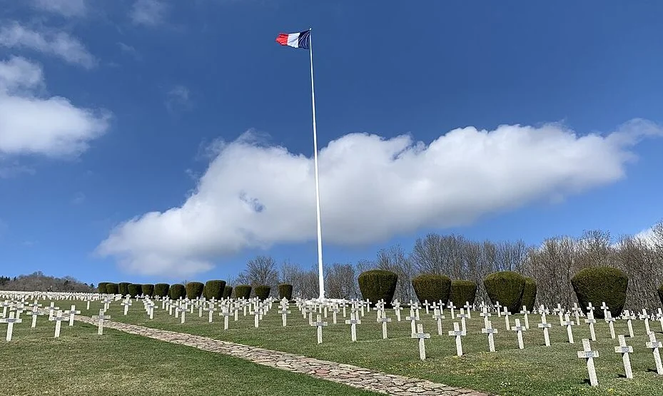
Just as military cemeteries tend to resemble one another, there’s a guiding hand behind France’s memorial sites too: anyone familiar with the style will immediately notice the resemblance to the American or British cemeteries in Normandie. The trenches and tunnels where the French soldiers once sat have been partially restored here, and they give a vivid sense of the living and survival conditions soldiers faced in what’s still called “the Great War” to this day. A large cross stands atop the mountain, visible from far away.
Practical Tips for Driving the Route des Crêtes
- The Route des Crêtes is a route meant for driving, and there’s no practical way to do it by public transportation. For tips on renting a car and important driving rules in France, see Car rental in France.
- If you’re coming from Paris, the most convenient option is to take a high-speed train to Colmar or Strasbourg and pick up your car there. It’s easiest to book train tickets in advance through Omio.
- A convenient base for the trip is one of the towns along the Alsace Wine Route. You’ll find lodging recommendations in our articles on hotels in Colmar, hotels in Kaysersberg and hotels in Riquewihr.
- The best season is from June to September, when every section of the road is open and the Alpine Garden is operating. In autumn, the forests paint the mountains in yellow and orange, just like in the photos in this article.
- Want to fold the Route des Crêtes into a bigger trip? On our Alsace page you’ll find all our articles about the region, including the history of Alsace.